Andy Waxman
Father, fullstack software engineer, tinker working to make the world a better place for all.
Socialization
Skills
- ASP.NET
- ASP.NET Core
- Microservices
- RESTful APIs
- C#
- Python
- Azure DevOps
- Telerik KendoUI
- TypeScript
- JavaScript
- Microsoft SQL Server
- Postgresql
- ArcGIS for Android SDK
- ArcGIS Server
- ArcGIS Desktop
- ArcView 3.x
- ERDAS Imagine
Publications, Awards
A collection of articles, maps and awards from when spatial was still “special”.
AWARD - Multiviewer for ArcGIS: Frost & Sullivan Customer Value Enhancement Award in the Geotechnologies
BOOK - USGS Map-On-Line: Interactive Maps for the Greater San Francisco Bay Area
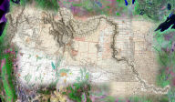
AWARD - Lewis and Clark Expedition 200th Anniversary Mosiac
AWARD - Maplicity for ArcIMS
Article - ArcIMS 3.0 -- An Application Developers Perspective.
BOOK - Satellite Imagery as Data Source
BOOK - Formations Vegetales el Domaine Forestiers
Experience
Senior Software Developer
Lead developer on Relay product team. Relay product includes SPA frontend based on the DurandalJS framework and multiple RESTful APIs build with ASP.NET and ASP.NET Core backends.
Senior Programmer/Analyst
Lead developer on MapOptix product team. Spearheaded transition from ArcIMS to ArcGIS Server.
Chief Technology Officer
Developed Maplicity for ArcIMS product suite, MapImager for ArcGIS Desktop, and QuadViewer for ArcGIS Desktop.
Programmer/Analyst
Software developer on various customer projects using ArcIMS, ArcView 3.x, and MapObjects Technologies.
Application Scientist
Provided geospatial services to internal customers. Services include developing scripts and utilities to process data, map creation, and data entry.
Education
Wait! There's more..
See all Blogs for more examples!